By: Sheikh Alkinky Sanyang
A team of technical experts from different stakeholder institutions, recently converged at the Ocean Bay Hotel, to validate the Environmental and Social Impact Assessment (ESIA), of ten road networks to be constructed within the country’s three administrative regions of the Upper, Central and North Bank.
The United Nations Office for Project Services (UNOPS), through the European Union, is implementing a three year project to ‘reinforce Access to the most vulnerable populations to markets and socio-economic facilities, through a Feeder Roads Rehabilitation Programme.
The key objective of the project is to provide communities, access to markets and health services among other social amenities. In accordance with Gambian National Legislation and Environmental Impact Assessment 2014, an environmental approval must be sought from the National Environmental Authority (NEA), prior to commencing the construction activities for the project. The document presents the findings of ESIA, undertaken for the ten feeder roads. The report include appropriate cost effective mitigation measures for implementation.
In his welcome remarks, NEA’s Acting Director of Technical Services Dr. Dawda Badgie, disclosed that environmental and social baseline studies were undertaken to obtain up to date information of the communities, where the project will be implemented. Due to time constraints, Badgie said environmental baseline information was sourced from existing reports of the project areas and other secondary literature, while the socioeconomic information was obtained by conducting household field surveys and stakeholder consultation programs.
According to Dr. Badgie, stakeholder consultation was an essential part of the ESIA studies to identify potential Project Affected Persons (PAPs), while stakeholder consultations also provided an opportunity for community members to present their grievances, comments and issues, about the project.
‘‘The assessment exercise, is to present a description of the project alongside findings of the environmental and socioeconomic baseline conditions of the project area, to evaluate the significance of predicted environmental and social issues associated with the development, operation and closure of the project, to prescribe mitigation measures that would be employed to minimize or completely eliminate potential environmental and social impacts of the project,’’ Dr. Badgie said.
In addition, he reiterated that the proposed Social and Environmental Monitoring and Management Plan, would be implemented during the entire life of the project, to monitor the performance of mitigation measures and identify unforeseen issues, and to provide stakeholders and potentially project affected persons (PAPs), an opportunity to present their views and concerns about the project.
Malang Jammeh, Deputy Permanent Secretary at the Ministry of Works, disclosed that road infrastructure and the transport sector, plays a strategic role in the socio-economic development of the country; that the availability and access to good roads is a significant indicator for promoting and ensuring that economic gains, reach the diverse population in every country; that the transport sector is known to account for a substantial percentage of the country’s GDP and generates a significant share of the total budgetary revenue of the country, as supported by international donor funding organizations.
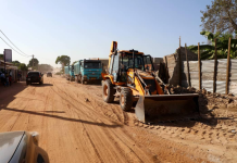
The Project’s environmental and social assessment was undertaken to include road networks within three administrative regions of the country: Upper, Central and North Bank Regions. Going through the document, Saikou B M Njai, a local consultant, disclosed that a total of 104 km of trunk and inter village roads, would be constructed; that in the Upper River Region (URR), Soto Masamba of Fuladu East, will benefit from a trunk road of 4.9 km; a 7.8 km trunk road will connect Chamoi through Dampha Kunda, to Tamba Sansang, in Tumana; a 23.4 km trunk road will also connect Suduwol to Fatoto in Kantora; another 17.4 km road connects Sambar Kunda to Kulari Ndimba in Tumana and Kantora, and a 7.6 km road connects Baja Kunda to Boro Kandakase in Wuli.
In the North Bank Region, a 2.6 km trunk road will connect the highway to Alkali Kunda; another 6.7 km road will connect Illiasa to Katchang, all in the Upper Baddibu District. A17 km road connects Fass to Kerr Selle in the Lower Niumi and a 9.6 km road connects Kerewan to Njawara in the Lower Baddibu.
In the Central River Region (C.R.R), the main road from Galleh Manda in Fulada West measuring 7.4 km will be constructed.
