


By Nelson Manneh
Despite their obvious value, forests have been steadily razed for decades to make space for agriculture, habitation and grazing and to obtain wood for fuel, manufacturing and construction. However, if lessons from past failures on reducing deforestation can be learned, forest protection can play a major role in reversing both climate change and biodiversity loss.
Forests are synonymous with life on earth. They are the main source of oxygen, habitat, food, fuel wood, identity and culture. It was under a tree that Isaac Newton had his “Eureka” moment, and under the shelter of a fig tree, the Buddha achieved enlightenment.
Humans have destroyed much of the world’s forests, but not for lack of attention. The world has long been aware of forest loss and its consequences.
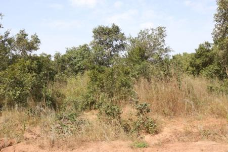
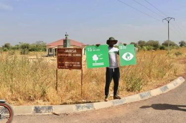
The Gambia, like other African countries, continues to lose its forest cover due to illegal settlements, bush burning, charcoal production and agriculture among others, exacerbating the effects of climate change.
And this exploitation of carbon-sinking resources like forests, is transforming such countries into carbon emitters, further jeopardizing their wildlife and leading them to the extinction of species inhabiting such crucial habitats.
A carbon sink is anything that absorbs more carbon from the atmosphere than it releases, for example, plants, the ocean and soil. In contrast, a carbon source is anything that releases more carbon into the atmosphere than it absorbs, for example, the burning of fossil fuels or volcanic eruptions.
Carbon dioxide emissions are those stemming from the burning of fossil fuels and the manufacture of cement. They include carbon dioxide produced during consumption of solid, liquid and gas fuels and gas flarings.
Two major forest parks (Nyanibereh and Bijilo National Forest Parks), were recently partially de-Gazetted by the Government. With Brikama Nyambai Forest not an exception, individuals continue to cut down trees in search of firewood and roofing materials among others.
Changes in mangrove vegetation have been identified as important indicators of environmental deterioration. The mangroves of the Tanbi Wetland National Park (TWNP) connects the Atlantic Coast with the estuary of the River Gambia and as such, plays an invaluable role in the agriculture, tourism and fisheries sectors of The Gambia and her economy.
Mangroves, which are estimated to extend up to 160 km from the coast along the River Gambia and covering an estimated area ranging between 497 and 747 km, are among the most crucial plants in West Africa.
Among other functions, mangroves provide food such as fish, oysters, shrimps and domestic products such as wood fuel and timber for construction, and perform various regulatory functions such as coastal protection and carbon sink.
The role of human activity in the degradation of estuarine resources has been well documented. Besides, the effects of climate change and activities such as clearing of mangroves for tourism and the use of inappropriate fishing gear and excessive use of pesticides for agricultural productivity are the most powerful ecological stressors. In the Sahelian climate zone, hydro-logical regimes are changing due to reduced river flow and increase in atmospheric temperatures leading to the formation of inverse estuaries.
However, the evaluation and documentation of local adaptation practices is one way to prevent “conservation bottlenecks” and encourage sustainable use of estuarine resources.
The Tanbi wetland that has been reserved has now been destroyed due to desertion by the government.
About Nyanibereh Forest Park:
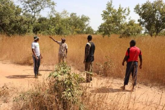
Nyanibereh Forest Park, situated in the Lower River Region of The Gambia between the communities of Buiba and Karantaba, holds a historical significance as it was established back in 1954 as part of a German government project in The Gambia.
This ancestral land connects the five satellite villages of Buiba, Jabisa, Karantaba, Foroya and Musa Wuriyah. While these communities maintain their community-based forests for sustenance, a recent issue has emerged with encroachment into the Forest Park.
About Bijilo National Park:
The Bijilo National Park commonly called ‘Monkey Park’ lies in the coastal zone next to the beach, about 11km west of Banjul, in the Kombo Saint Mary’s District of The Gambia in West Africa.
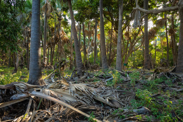
The species-richpark is a fenced woodland, which was gazetted in 1952, covers an area of 51.3 hectares and lies on the Atlantic Ocean beach on the southern end of the Senegambia area of Kololi.
The park has a total length of 1,500 meters parallel to the coast and a width of 350 meters, with deep well drained soils. This protected nature reserve consists primarily of a closed canopy of forest with a significant number of Rhun palms, with a relatively thin strip of herbaceous dune vegetation.
Between 1951 and 1956, the only land management activity implemented in this park was the clearing of fire lines along the boundaries on both sides of the fence. In 1977, the park was re-surveyed by the Department of Forestry and again in 1982, followed by an inventory of what is found therein. A nature trail was created by the Gambia-German Forestry Project in 1991, when the area was made open to the public receiving about 23,000 visitors a year.
The nature trail within the Bijilo Forest Park is over 4.5 km withsignposted footpaths that winds its way through contrasting habitats of forest, coastal shrubland and sand dunes. The majority of it is reasonably leveled though there are several steeper inclines with roughed out steps.
For the park’s visitors, there are wooden benches and shaded covers set up at convenient points along the path and also some viewing areas overlooking the sand dunes, beachfront and the Atlantic Ocean.
There is also a ‘straight’ footpath which cuts through the shrub and forest close to the beach called the ‘ornithological path’. This route provides good opportunity for visitors to spot many of the park’s bird life. There is also a pond in the forest which is maintained and acts as a watering hole for many creatures.
Mustapha Minteh, a tourist tour guide with a seven-passenger vehicle, said he has been in the trade for the past twenty years and has been taking tourists mainly to different forests within the country.
“The leveling down of parks mainly Bijilo (Monkey) Park has caused a lot of disaster to the nation especially to the Tourist fraternity. In those days, we sometimes spend a whole day at the Bijilo Park with tourists watching different birds and monkeys but now that is history,” he said.
Mr Minteh said preservation of natural resources is very important and it is the responsibility of the government to protect them as the law gives them powers to gazette and de-gazette forests and parks.
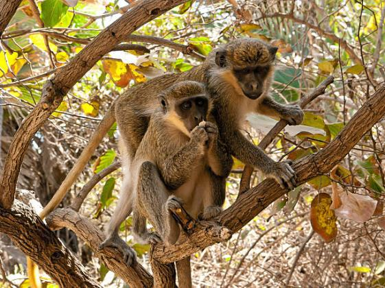
“The red monkeys that are found at the Bijilo Park are rare to see outside. This is why that park is very sensitive and needs to be protected. Gambians would have resided in the area since in the 70s but it was preserved for the younger generations. The de-Gazetting of this pack shows the weakness of our government,” he said.
Navigating through the stress of going far to see red monkeys, Mr Minteh said they now travel to the interior to see some of these animals.
“Times are coming and those times are near, there will be nothing like Tourism in the Gambia because there will be no natural resource preserved for sight seeing,” he said.
De-gazetting of Nyanibereh and Bijilo National Forest Parks
On the 26 October 2023, the Gamnia’s national television (GRTS) announced that cabinet had unanimously agreed to de-gazette a portion of Nyanibereh and Bijilo National Forest Parks.
Mr. Muhammed Hydara, the Secretary of the Gambia Environment Alliance, said the National Determine Contributions (NDCs) shared with the international community mandates the government to commit to protecting 30% of the country’s forest cover by 2030.
“The action of de-gazetting portions of two forest parks does not align with the NDCs goals. Additionally, the biodiversity of these parks particularly Bijilo National Park, plays a crucial role in the national heritage and ecotourism,” he said.
Mr. Hydara highlighted the endangered red colobus monkey population now gets fewer than a hundred.
Mr. Kemo Fatty, an environment and climate change activist, highlighted the significance of Nyaniberi Forest and expressed concerns about allocating portions of the park to specific groups based on accessibility.
“In 2017, MECCNAR had written a letter to the governor of Lower River Region to evict some groups of people who have settled in the forest park,” he said. He pledged support for taking appropriate legal action against the groups for violating the law rather than de-gazetting eighty hectares for their settlement.
Rohey John Manjang, the Minister of the Environment, said de-gazetting of the two forest parks was initiated by the former regime through a presidential proclamation, without due process or diligence, adding that the current government is now working to rectify these past decisions.
In the case of Nyanibereh forest, the Minister explained that the community of Jabisa requested to live closer to the main highway for accessibility, and this request was supported through a proclamation.
“A report recommended allocating two hundred hectares for the new settlement, but my Ministry limited it to 82.7 hectares while safeguarding the bulk of the forest covering 1082.7 hectares,” she said.
Regarding the Bijilo Forest Park, the Minister of the Environment clarified that the announcement by GRTS aims to formalise an already de-gazetted portion where a conference centre was built.
“However, the news report also mentioned a hotel and an office space for AREZKI Company, which raised concerns,” she said.
GEA Opposes De-Gazetting of National Parks:
In October 2023, the Gambia Environment Alliance (GEA) expressed deep concern over the Government’s decision to de-gazette parts of Nyaniberi Forest Park in Jarra and Bijilo National Park in Kanifing Municipality, for office buildings, hotels and a village.
“These forests are vital to The Gambia’s biodiversity which is already under stress from encroachments and climate change,” the GEA stated.
Bijilo Forest Park was gazetted in 1952 and Nyaniberi Forest Reserve in 1954.Both are home to diverse flora and fauna including red colobus monkeys, hyenas and unique bird species.
These reserves enrich the biodiversity of the country and benefits communities by boosting the national economy through tourism, and to de-gazette them risks the sanctity of these natural habitats and endangers the already endangered species that live therein.
GEA urges the Government to reverse its decision by upholding constitutional and legal obligations to protect the environment, notably the Banjul Declaration, Biodiversity and the Wildlife Act and the Forestry Acts.
GEA further indicated that disruption of natural habitats increases conflicts between mammals like monkeys, hyenas and the human populations, and said such encroachment jeopardizes their safety and well-being.
The GEA said they are resolute in their commitment to protect the country’s natural heritage, and urges the Government to act to safeguard the country’s parks by enforcing all environmental laws, and mitigate climate change effects.
The Banjul 2022 Flood
The Gambia, like any other country around the globe, faces the impacts of climate change. This has led to erratic patterns of rainfall for the past years, and the year 2022 was no exception to this as the rains started earlier than normal, with the rains predicted to be above normal and accompanied by strong winds.
The Banjul flood in 2022 was also attributed to some environmental damages, and some attributed this to environmental damages around the Tanbi Wetland.
This has led to mass flooding across the country, and some houses were severely affected whose occupants were evacuated to public buildings such as health facilities, mosques and schools for safety.
Similarly, heavy rains and flooding was also realised from the 3rd to 5th of August 2022 in the Upper River Region and other parts of the country, and this is expected to continue due to climate change.
The regions affected by the floods include Banjul, Kanifing Municipality, West Coast, North Bank, Lower and Upper River Regions. In the North Bank Region, the floods claimed the lives of four children while one was left in critical condition as a result of the thunderstorm that was accompanied by the rains of 30th July 2022. Another person was also reported dead in the West Coast Region.
According to the Meteorological Department, slight to moderate rain and thunderstorms was expected to prevail over the country during the night of Saturday 30th July 2022.
Torrential, moderate to heavy rain and thunderstorms was also expected over the country from the early hours of Sunday 31st July 2022, until late in the afternoon which was predicted to result to flash flooding over areas prone to flooding. For the 1st of August, the wet conditions were expected to prevail over most places in the early hours of the morning particularly the western sector.
On 2nd August 2022, heavy rain and thunderstorm was expected to prevail over places especially the inland sector from the early parts of the forecast and part of the day.
Most of these predictions were realised which led to the current flooding situation.
Preliminary information obtained as of 01 August 2022 from the first situational report produced by the NDMA, indicated that a total of 17,201 people from 1,961 households were affected. The impacts include destruction of houses, food stocks, toilet facilities and household items. The assessments identified at least 47,104 people who were directly affected by the heavy downpours, and suburbs in urban settlements have been the hardest hit by the floods. Rural areas have also suffered greatly.
The 2022 flooding in Banjul had caused a lot of setback for many families who fled their residences to temporarily reside at the St. Augustine’s Senior School.
Some environmental specialist said climate change will continue to hit Banjul if necessary steps are not taken as soon as possible.
Hon. Modou Lamin Bah, the National Assembly Member for Banjul North said the 2022 flooding was not a natural disaster but a“negligent action from the side of the government. That knowing the history of Banjul, the only way out is to protect the reserve lands especially the Tanbi Wetland. The Banjul North NAM said the mangroves around the Tanbi Wetland served as protection and mitigates floods and other natural disasters.
PROTECTED AREAS IN THE GAMBIA 2021
| NAME OF PROTECTED AREA | DATE ESTABLISHED | TOTAL AREA (ha) | Administrative Area | |
| NATIONAL PARKS AND RESERVES | ||||
| 1 | Abuko Nature Reserve | 1968 | 134 | KMC/BAC |
| 2 | River Gambia National Park | 1978 | 589 | Janjanbureh-CRR |
| 3 | Niumi National Park | 1986 | 7,758 | Kerewan-NBR |
| 4 | Kiang West National Park | 1987 | 23,621 | Mansakonko-LRR |
| 5 | Boa Bolong Wetland Reserve | 1993 | 29,650 | Kerewan-NBR |
| 6 | Tanji Bird Reserve | 1993 | 612 | Brikama-WCR |
| 7 | Tanbi Wetland National Park | 2001 | 6034 | Greater Banjul Area |
| 8 | Jokadou National Park | 2019 | 19,293 | Kerewan-NBR |
| 9 | Kassan Conservation Area | 2018 | 2,160 | Janjanbureh-CRR |
| Total Area of National Parks and Reserves (ha):89,851 | ||||
| National Parks Coverage: 8.2% | ||||


